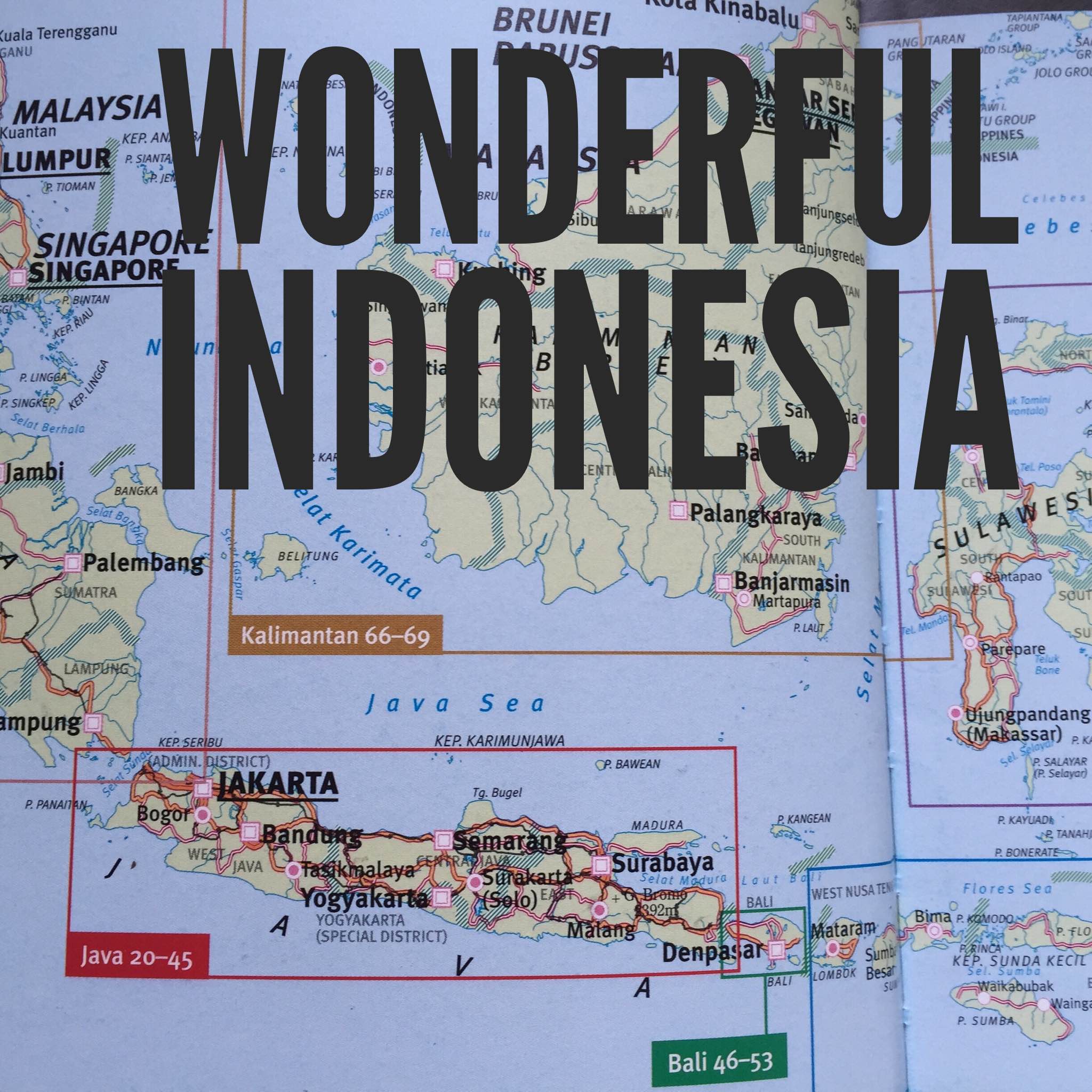
Wonderful Indonesia – a diverse archipelago!
When starting a new Indonesian class and/or a new Indonesian Languages program one of the most important things to ensure your students learn and know is that Indonesia is made up of over 18,000 islands. I believe it’s really important that students know that Indonesia is NOT just Bali – you’re hearing me, right?! {as Bali is probably the one island they have possibly heard of and know about – either from a family holiday, hearing about it from friends or seeing it on TV} but Indonesia is actually made up of many, many islands, all that have their own language, culture, traditions and arts.
Thinking back to my teaching days, I remember thinking; how am I going to teach my students about all the islands in Indonesia? I, myself, have been travelling to Indonesia and studying about Indonesia for over twenty years and I still haven’t learnt everything there is to know about all the islands in Indonesia! All so diverse and unique. I’m still learning.
I quickly realised that it’s an impossible task to teach EVERYTHING about all the islands – especially with only two hours of Indonesian classes per week {or less!}. Let’s not be unrealistic about our objectives and expectations on our students and ourselves!
But I did come to the conclusion that I could teach my students a little about each of the main islands in Indonesia. When I say ‘main’ islands, I mean Sumatra, Kalimantan {Borneo}, Java, Bali, Nusa Tenggara Timor {NTT} – including Lombok, Sumbawa, Sumba, Flores, Alor Archipelago and West Timor, Maluku and Papua {that’s not to exclude or show lack of interest of the other islands – it’s just as I said, it’s impossible to cover the entire geography of Indonesia in only a couple of hours per week!}.
I thought long and hard about how best to capture the uniqueness of each of the main islands in Indonesia and how to give my students an insight into the wonderful diversity of the islands that make up Indonesia.
So, I came up with this…
Wonderful Indonesia!
A study of the map of Indonesia – main islands – and their most well known features.
Introduce students to a map of Indonesia and the main island names/areas. Discuss factual information such as; over 18,000 islands, over 500 different dialects/languages, each island/province has different traditional houses, traditional costumes, food specialties and so on.
Students form groups of 4 – 5 {or less, depending on your class size, of course} and each group is given a laminated cut-out of one of the main islands. *I did this by photo-copying and enlarging each main island to the size I wanted, which was really quite big. You could also do it by projecting a map of Indonesia onto a huge blank wall and making a big stencil of each main island.
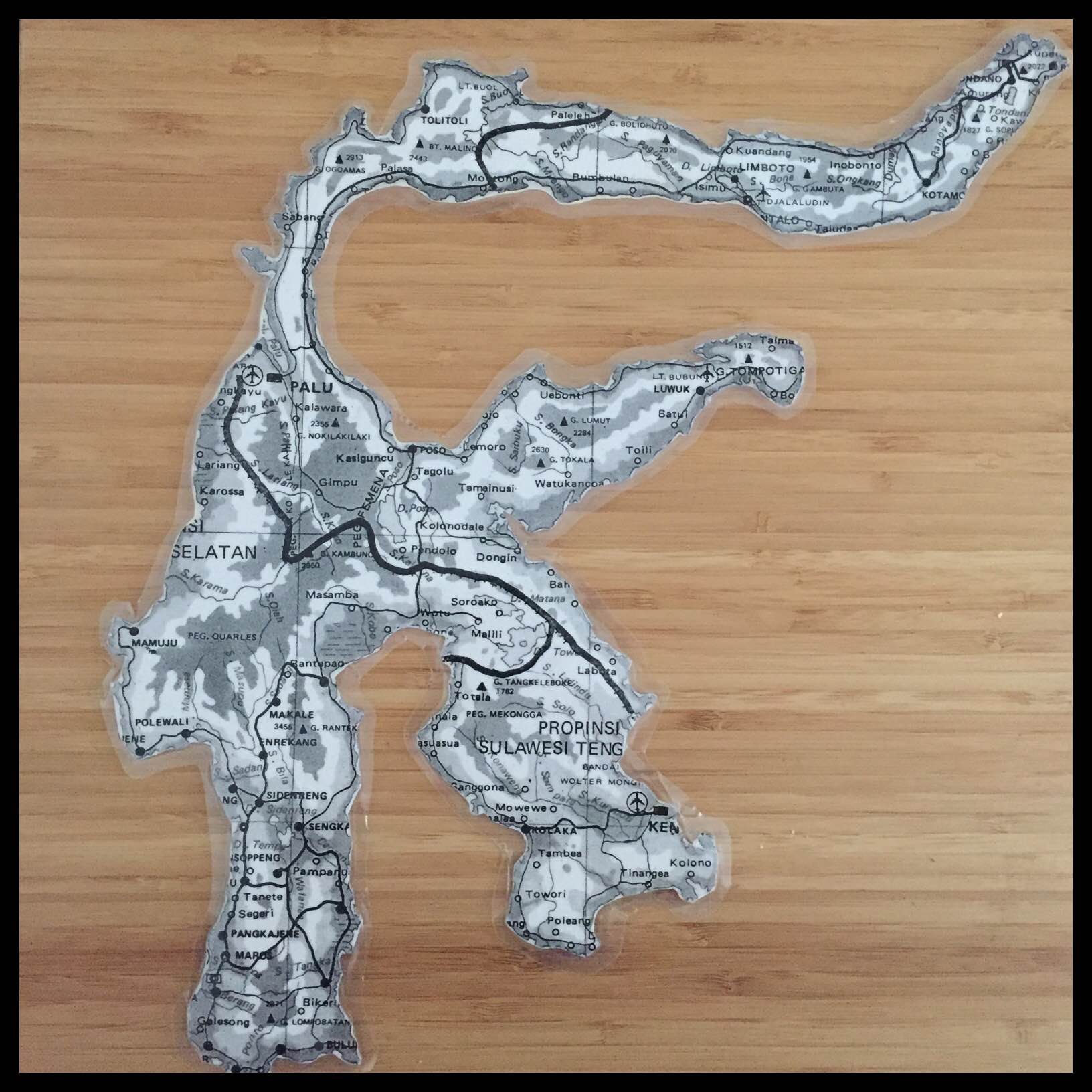
The students’ task is to create a poster about their main island. They can begin by tracing their stencil or drawing their island; marking in major cities and roads. They then need to include any major tourist attractions on their island. They can do this by researching on the internet. Another idea for this {particularly for younger students, or if you don’t have access to the internet} is to provide your students with an A4 card with pictures and information about their island and they can extract the information they want to include on their poster.
Students decorate their poster with written information, illustrations and/or pictures from the internet or even cut out from travel brochures and magazines.
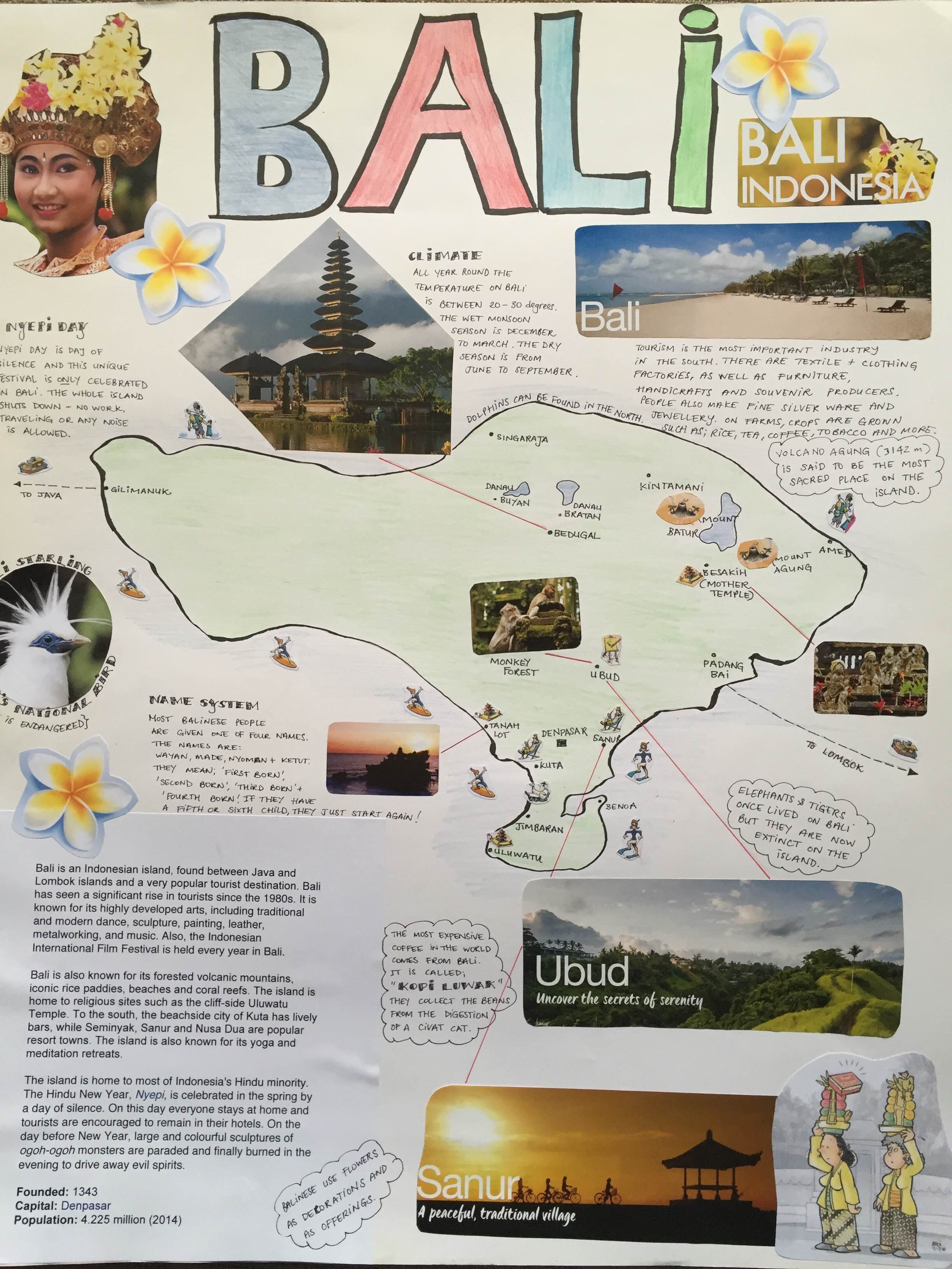
Students then present and share their poster and what they have learnt about their island with the class, so that all students gain an insight and some knowledge about each of the main islands, from all the presentations.
The posters look fantastic when displayed, and can be displayed in such a way that they form the map of Indonesia, by placing the islands in an approximate location to where they would be found on a map of Indonesia. Having the island posters displayed in this way ensures that others in the school and even parents and the wider school community can also learn about the wonderful islands of Indonesia!
And there you have it, a brief introduction to ‘Wonderful Indonesia’ and it’s main islands and highlights. It’s a great basis to begin your language and culture classes, and I’m sure that each student in your class will find at least one piece of information that will interest them and quickly grab their attention, which will in turn motivate them and encourage them to want to learn more. It may be surfing spots across the archipelago or the komodo dragon or the orangutan, maybe even adventuring in the jungles of Kalimantan or perhaps the intricate traditional costumes or dances of Bali. Whatever it is, I’m sure your students will find something that interests them, which will inspire them in their studies of bahasa Indonesia.
On the Language Learning Space, there are some great links to explore to assist you with your study of ‘Wonderful Indonesia’ that you could look at together as a whole class. Start by looking at the Challenge; ‘Destination Dragon‘ and as a class read the graphic novel and discuss as a class. Some other useful resources to find within this Challenge are; a Quizlet set: Perjalanan di Indonesia for some useful vocabulary, Brosur – Indonesia Indah, e-kartu pos dari Yogyakarta and Blog Jeani – all of which could be read together as a class {for language assistance for younger students}. And one last link, which is great for research is the Wonderful Indonesia website.
Also, if you wanted to introduce your lesson with a video for some initial inspiration, this one by Sekretariat Kabinet Republik Indonesia is great! Click here for the video.
Have fun! – Selamat menyenangkan!
Have you taught your students about the wonderful diverse islands of Indonesia?
How did you go about it?
Were your students amazed at the diversity of the Indonesian archipelago?
And did it motivate them to want to learn more?
I’m not a teacher but I want to go there!!!!!
xx cathy
Many great islands to visit and explore in Indonesia, Cathy! 🙂
Looks and sounds really good Julie, thanks for sharing!
Glad you enjoyed the post Narelle, hope you find the info and the links useful for your Languages program.
I always begin my Kind Yr1 class in Term 1 with a laminated map that they can locate Indonesia on. They can see where it is, how wide spread. They can also find Australia and New Zealand plus any other country that a student in the class is from. They can color in the islands of Indonesia also. We revise this each term.
It’s interesting that you have brought this topic up as my current year7class has just begun an in class project on researching 2 islands each. This info will really help. Thanks.
That’s a great idea Ruth! I’ve also done the whole map activity with students, it’s really important they know where Indonesia is in comparison to Australia and other relevant countries. Glad that my blog post and the links will be useful to you and your students. 🙂